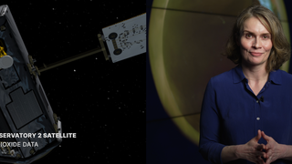
Leveraging NASA Research to Safeguard the U.S. East Coast from Hurricanes
16x9 optimized for YouTube
Music: Downloading Landscapes by Andrew Michael Britton & David Stephen Goldsmith and Swift Response by Miguel D' Oliveira
This video can be freely shared and downloaded. While the video in its entirety can be shared without permission, some individual imagery provided by Pond5.com and NOAA is obtained through permission and may not be excised or remixed in other products. For more information on NASA’s media guidelines, visit https://www.nasa.gov/multimedia/guidelines/index.html
Complete transcript available.
Withstanding the Storms
The scariest thing about a hurricane is not knowing what to expect. Hurricanes are getting stronger due to climate change warming the air and oceans. NASA atmospheric scientist Mara Fuentes says NASA sees deep into hurricanes to better their power, track storms through the night, and precisely map flooding in real time. NASA shares this information with partners like NOAA for weather forecasts and FEME to support emergency responders. Before, during, and after a hurricane, NASA data is put to use by decision makers to make critical decisions.
Full 8K resolution. Optimized for Earth Information Center display.
Right circle display video
Left circle display video
Credits
Please give credit for this item to:
NASA's Goddard Space Flight Center
-
Producer
- Jon Walton (NASA/JPL)
-
Scientist
- Marangelly Fuentes (SSAI)
-
Editor
- James Round (NASA/JPL CalTech)
-
Project support
- Helen-Nicole Kostis (USRA)
- Ellen T. Gray (NASA/HQ)
- Katie Jepson (KBR Wyle Services, LLC)
-
Videographers
- Rob Andreoli (Advocates in Manpower Management, Inc.)
- John D. Philyaw (Advocates in Manpower Management, Inc.)
Release date
This page was originally published on Wednesday, June 21, 2023.
This page was last updated on Monday, January 6, 2025 at 1:35 AM EST.
