March 13-14, 2025 Total Lunar Eclipse: Visibility Map
An animated map showing where the March 13-14, 2025 lunar eclipse is visible. Contours mark the edge of the visibility region at eclipse contact times. The map is centered on 102°13'W, the sublunar longitude at mid-eclipse.
See also the shadow diagram and Dial-a-Moon for this eclipse.
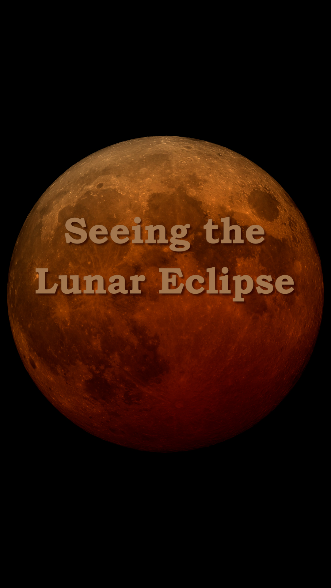
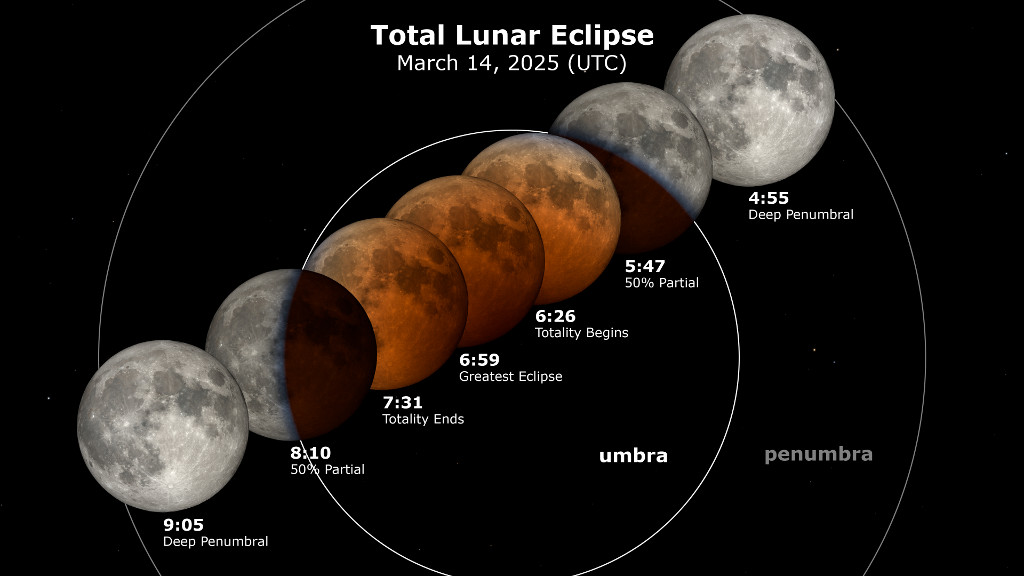
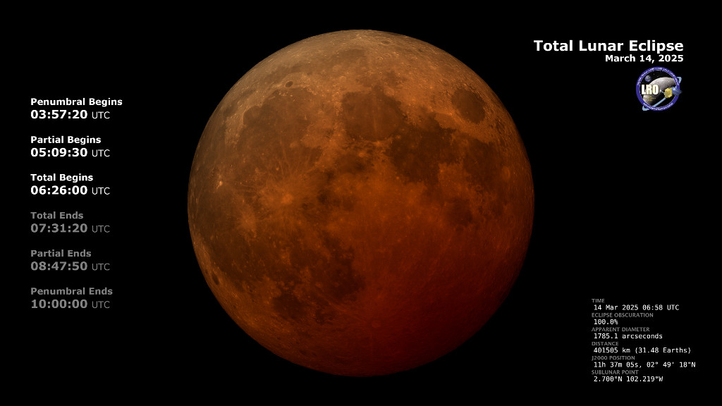
On March 14, 2025 (the night of March 13), the Moon enters the Earth's shadow, creating a total lunar eclipse, the first since November of 2022. This animation shows the region of the Earth where this eclipse is visible. This region shifts to the west during the eclipse. Observers near the edge of the visibility region may see only part of the eclipse because for them, the Moon sets (on the eastern or right-hand edge) or rises (on the western or left-hand edge) while the eclipse is happening.
Contour lines mark the edge of the visibility region at the contact times. These are the times when the Moon enters or leaves the umbra (the part of the Earth's shadow where the Sun is completely hidden) and penumbra (the part where the Sun is only partially blocked). For observers located on a contour line, the contact occurs at moonrise (west) or moonset (east).

A map showing where the March 13-14, 2025 lunar eclipse is visible. Contours mark the edge of the visibility region at eclipse contact times. The map is centered on 102°13'W, the sublunar longitude at mid-eclipse.
Mapa de la Tierra que muestra los lugares donde será visible el eclipse de Luna del 13 al 14 de marzo de 2025. Los contornos marcan los bordes de la región de visibilidad en las horas de contacto del eclipse. El mapa está centrado en la coordenada 102°13'W, que es la longitud sublunar en la mitad del eclipse.
The mask defining the visibility region, centered at 0° longitude.
Credits
Please give credit for this item to:
NASA's Scientific Visualization Studio
-
Visualizer
- Ernie Wright (USRA)
-
Translator
- Noelia Gonzalez Moreira (ADNET Systems, Inc.)
Release date
This page was originally published on Thursday, January 30, 2025.
This page was last updated on Tuesday, February 18, 2025 at 12:15 PM EST.
Missions
This page is related to the following missions:Datasets used
-
Earth at Night [DMSP: OLS]
ID: 286 -
DE421 (JPL DE421)
ID: 752Planetary ephemerides
This dataset can be found at: http://ssd.jpl.nasa.gov/?ephemerides#planets
See all pages that use this dataset
Note: While we identify the data sets used on this page, we do not store any further details, nor the data sets themselves on our site.
Related
- ID: 14791
- ID: 5471
 Visualization
 - ID: 5472
 Visualization