Perpetual Ocean 2: Polar Views
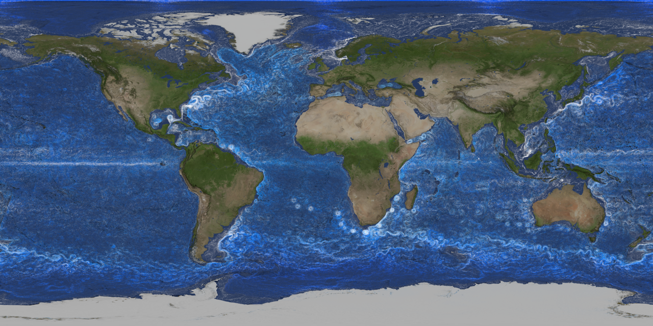
These visualiztions are north and south polar views of ECCO-2 ocean flow data that are part of the Perpetual Ocean 2 releases. There are versions of north and south poles separately and together.
For more details, see: https://svs.gsfc.nasa.gov/5505
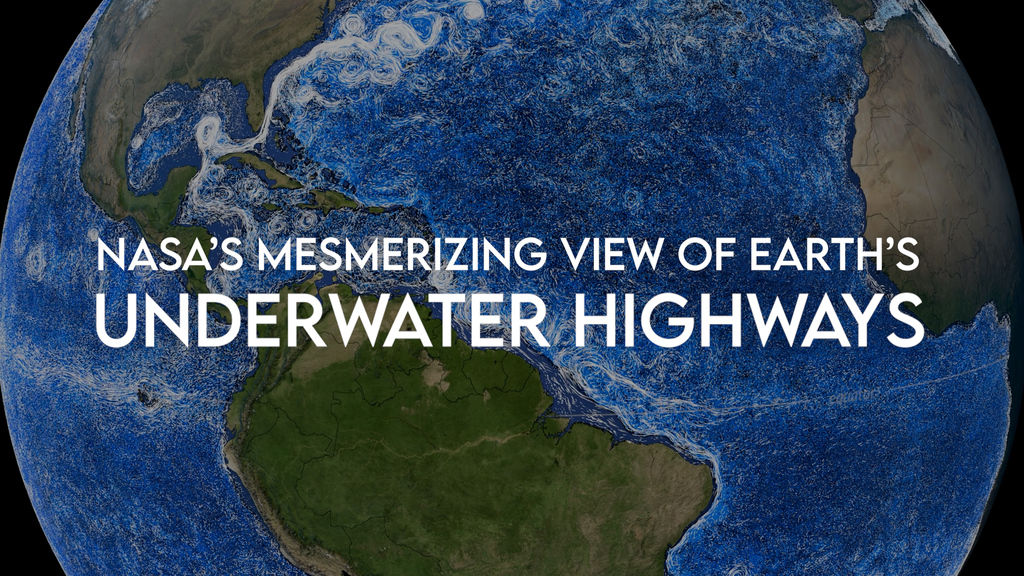
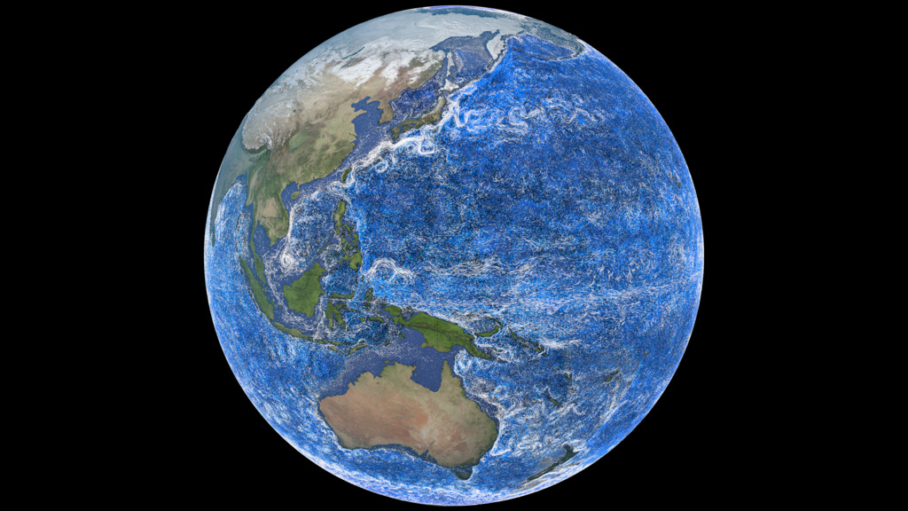
South pole view of ocean currents
North pole view of ocean currents
North and south pole views of ocean currents
Credits
-
Visualizers
- Greg Shirah (NASA/GSFC)
- Horace Mitchell (NASA/GSFC)
-
Scientist
- Atousa Saberi (NASA/GSFC)
Release date
This page was originally published on Friday, April 25, 2025.
This page was last updated on Friday, April 25, 2025 at 9:59 AM EDT.
Series
This page can be found in the following series:Datasets used
-
ECCO2 (ECCO2 High Resolution Ocean and Sea Ice Model)
ID: 707 -
ETOPO-30
ID: 1216NOAA Earth TOPOgraphy global relief model 30 arc-second resolution (ETOPO-30): The ETOPO Global Relief Model integrates topography, bathymetry, and shoreline data from regional and global datasets to enable comprehensive, high resolution renderings of geophysical characteristics of the earth’s surface. The model is designed to support tsunami forecasting, modeling, and warning, as well as ocean circulation modeling and Earth visualization.
This dataset can be found at: https://www.ncei.noaa.gov/products/etopo-global-relief-model
See all pages that use this dataset -
BMNG (Blue Marble: Next Generation) [Terra and Aqua: MODIS]
ID: 508Credit: The Blue Marble data is courtesy of Reto Stockli (NASA/GSFC).
This dataset can be found at: http://earthobservatory.nasa.gov/Newsroom/BlueMarble/
See all pages that use this dataset
Note: While we identify the data sets used on this page, we do not store any further details, nor the data sets themselves on our site.
Alternate Versions
- ID: 14745
- ID: 5425
 Visualization
 - ID: 5505
 Visualization