2014 Total Lunar Eclipse
Overview
In the early morning hours of April 15, 2014 (UT), the moon entered the Earth’s shadow and created a total lunar eclipse that was visible from all of North and South America. This gallery contains multimedia resources related to the eclipse, including data visualizations, animations, narrated videos, and interviews with NASA scientists. Learn more about how NASA is studying the moon with the
Lunar Reconnaissance Orbiter.
Lunar Eclipse and LRO Edited Packages
Need To Know: Lunar Eclipse and LRO
Go to this pageOn April 15th, 2014 there will be a total lunar eclipse visible from North America. Noah Petro, LRO Deputy Project Scientist, discusses this unique event and what effect it will have on the Lunar Reconnaissance Orbiter (LRO). ||
Understanding Lunar Eclipses
Go to this pageWhat can cause the full Moon to quickly darken, then glow red? A lunar eclipse: a striking display of orbital mechanics that occurs when the Moon passes through the Earth's shadow. To learn more, watch the video below. ||
Earthrise: The 45th Anniversary
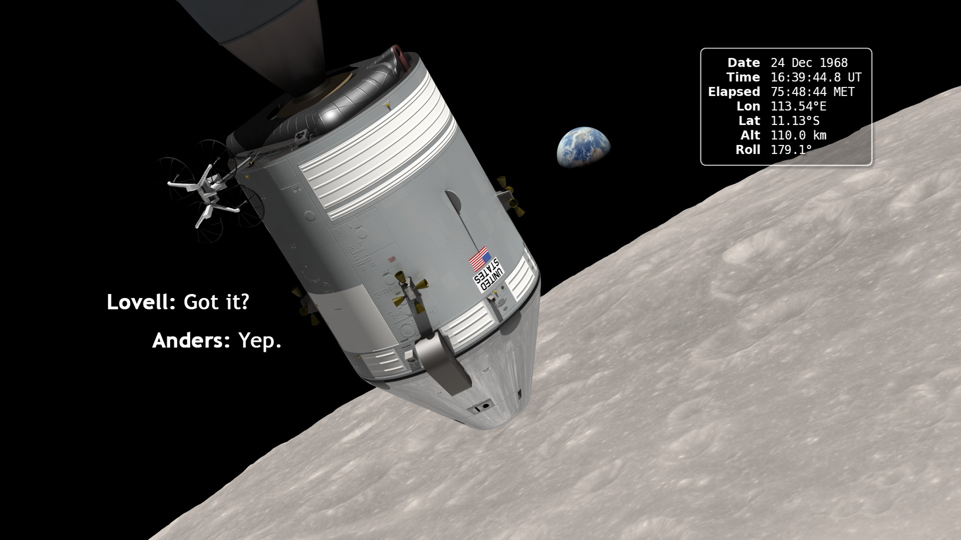
Go to this pageIn December of 1968, the crew of Apollo 8 became the first people to leave our home planet and travel to another body in space. But as crew members Frank Borman, James Lovell, and William Anders all later recalled, the most important thing they discovered was Earth.Using photo mosaics and elevation data from Lunar Reconnaissance Orbiter (LRO), this video commemorates the 45th anniversary of Apollo 8's historic flight by recreating the moment when the crew first saw and photographed the Earth rising from behind the Moon. Narrator Andrew Chaikin, author of A Man on the Moon, sets the scene for a three-minute visualization of the view from both inside and outside the spacecraft accompanied by the onboard audio of the astronauts.The visualization draws on numerous historical sources, including the actual cloud pattern on Earth from the ESSA-7 satellite and dozens of photographs taken by Apollo 8, and it reveals new, historically significant information about the Earthrise photographs. It has not been widely known, for example, that the spacecraft was rolling when the photos were taken, and that it was this roll that brought the Earth into view. The visualization establishes the precise timing of the roll and, for the first time ever, identifies which window each photograph was taken from.The key to the new work is a set of vertical stereo photographs taken by a camera mounted in the Command Module's rendezvous window and pointing straight down onto the lunar surface. It automatically photographed the surface every 20 seconds. By registering each photograph to a model of the terrain based on LRO data, the orientation of the spacecraft can be precisely determined.Andrew Chaikin's article Who Took the Legendary Earthrise Photo From Apollo 8? appeared in the January, 2018 issue of Smithsonian magazine. It includes the story of the making of this visualization.A Google Hangout discussion of this visualization between Ernie Wright (creator of the visualization), Andrew Chaikin, John Keller (LRO project scientist), and Aries Keck (NASA media specialist) was held on December 20, 2013. A replay of that hangout is available here.Ernie Wright presented a talk about the making of this animation at the 2014 SIGGRAPH Conference in Vancouver. He also wrote a NASA Wavelength blog entry about Earthrise that includes links to educator resources related to LRO. ||
Tour of the Moon
Go to this pageUsing elevation and image data returned by Lunar Reconnaissance Orbiter (LRO), this animation takes the viewer on a virtual tour of the Moon. The tour visits a number of interesting sites chosen to illustrate a wide variety of lunar terrain features. Some are on the near side and are familiar to both professional and amateur observers on Earth, while others can only be seen clearly from space. Some are large and old (Orientale, South Pole-Aitken), others are smaller and younger (Tycho, Aristarchus). Constantly shadowed areas near the poles are hard to photograph but easier to measure with altimetry, while several of the Apollo landing sites, all relatively near the equator, have been imaged at resolutions as high as 25 centimeters (10 inches) per pixel.The shape of the terrain in this animation is based primarily on data from LRO's laser altimeter (LOLA), supplemented by stereo image data from its wide angle camera (LROC WAC) and from Japan's Kaguya mission. The global surface color is from Clementine. ||
The Moon's Permanently Shadowed Regions
Go to this pageAs you watch the Moon over the course of a month, you'll notice that different features are illuminated by the Sun at different times. However, there are some parts of the Moon that never see sunlight. These areas are called permanently shadowed regions, and they appear dark because unlike on the Earth, the axis of the Moon is nearly perpendicular to the direction of the sun's light. The result is that the bottoms of certain craters are never pointed toward the Sun, with some remaining dark for over two billion years. However, thanks to new data from NASA's Lunar Reconnaissance Orbiter, we can now see into these dark craters in incredible detail. ||
Water on the Moon
Go to this pageSince the 1960’s, scientists have suspected that frozen water could survive in cold, dark craters at the Moon’s poles. While previous lunar missions have detected hints of water on the Moon, new data from the Lunar Reconnaissance Orbiter (LRO) pinpoints areas near the south pole where water is likely to exist. The key to this discovery is hydrogen, the main ingredient in water: LRO uses its Lunar Exploration Neutron Detector, or LEND, to measure how much hydrogen is trapped within the lunar soil. By combining years of LEND data, scientists see mounting evidence of hydrogen-rich areas near the Moon’s south pole, strongly suggesting the presence of frozen water. ||
2014 Lunar Eclipse Essentials
LRO and the Lunar Eclipse of April 15, 2014: Shadow View
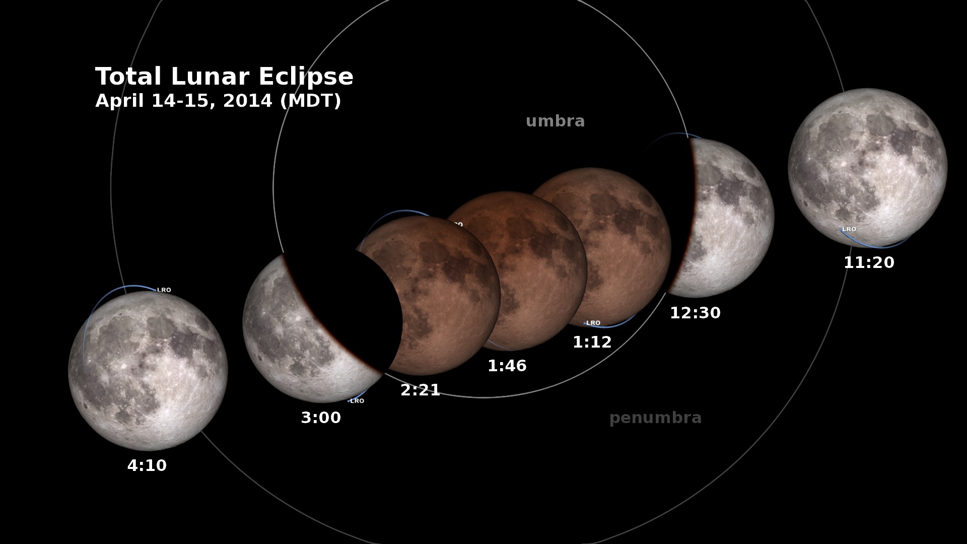
Go to this pageIn the early morning hours of April 15, 2014, the Moon enters the Earth’s shadow, creating a total lunar eclipse, the first of four that are visible in the Western Hemisphere in the next two years. This animation shows the changing appearance of the Moon as it travels into and out of the Earth’s shadow, along with the times at various stages. Versions of the animation have been created for each of the four time zones of the contiguous United States.All of North and South America will see this eclipse, and you won’t need special equipment to see it. Just stay up late, go outside and look up!The penumbra is the part of the Earth’s shadow where the Sun is only partially covered by the Earth. The umbra is where the Sun is completely hidden.The animation includes the position of the Lunar Reconnaissance Orbiter spacecraft. LRO is powered by sunlight, but during the eclipse, it will have to rely on its battery for almost three hours. ||
Lunar Eclipse of April 15, 2014 As Viewed from the Moon
Go to this pageIn the early morning hours of April 15, 2014, the Moon enters the Earth’s shadow, creating a total lunar eclipse. When viewed from the Moon, as in this animation, the Earth hides the Sun. A red ring, the sum of all Earth’s sunrises and sunsets, lines the Earth’s limb and casts a ruddy light on the lunar landscape. With the darkness of the eclipse, the stars come out.The city lights of North and South America are visible on the night side of the Earth. The part of the Earth visible in this animation is the part where the lunar eclipse can be seen. ||
Lunar Eclipses and the Moon's Orbit
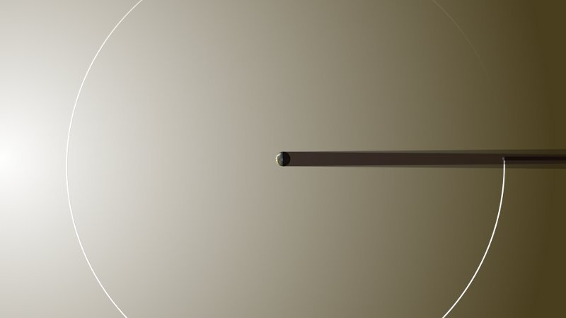
Go to this pageThe animations on this page illustrate the Moon’s orbit and its role in lunar and solar eclipses. A solar eclipse happens when the Moon’s shadow falls on the Earth, while a lunar eclipse happens when the Earth’s shadow falls on the Moon.Eclipses can only happen at New and Full Moon, when the Earth, Moon, and Sun are all in a straight line. But they don’t happen every New and Full Moon, because the Moon’s orbit is tilted by about 5 degrees. As the Earth and Moon travel around the Sun, the tilt of the Moon’s orbit changes direction relative to the Sun.This is analogous to the way the tilt of the Earth causes seasons. Just like winter and summer happen every six months, eclipses tend to occur on a roughly six-month cycle.Unlike most eclipse shadow diagrams, the first three animations here don’t greatly exaggerate the scale of the Earth and Moon. They are only 2x their true scale. The view is exactly perpendicular to the Earth-Sun line. The angle of the Moon’s orbital tilt and the “tapering” of the shadows are both accurate. The orbit happens to be calculated for the months preceding the April 15, 2014 total lunar eclipse. ||
LRO and the Lunar Eclipse of April 15, 2014: Telescopic View
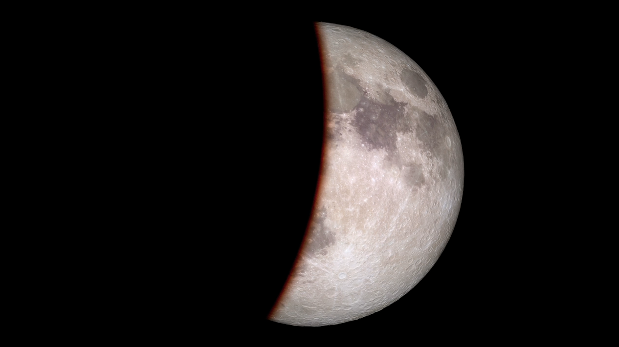
Go to this page|| || eclipse.0001.jpg (730x730) [104.6 KB] || eclipse.0001.tif (1920x1080) [2.5 MB] ||
2014 Live Shot Broll
Moon Resources
Moon Phase and Libration, 2014
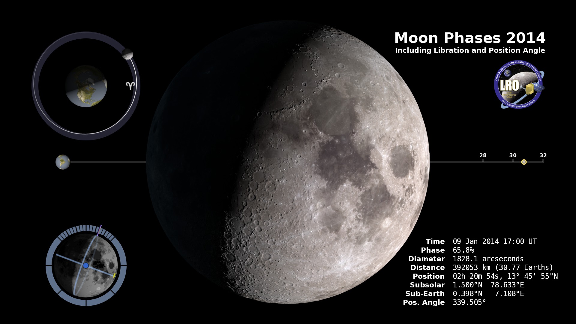
Go to this page|| The data in the table for the entire year can be downloaded as a JSON file or as a text file. || moon.0001.jpg (730x730) [27.9 KB] || comp.0001.tif (1920x1080) [1.5 MB] ||
Moon Phase and Libration, 2014 South Up
Go to this page|| The data in the table for the entire year can be downloaded as a JSON file or as a text file. || moon.0001.jpg (730x730) [27.7 KB] || comp.0001.tif (1920x1080) [1.5 MB] ||
LRO and LADEE Resources
LRO Spacecraft Animations
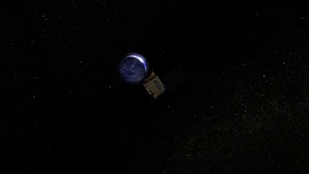
Go to this page11 animations of the Lunar Reconnaissance Orbiter's (LRO) journey around the Moon. ||
NASA Downloads the Future
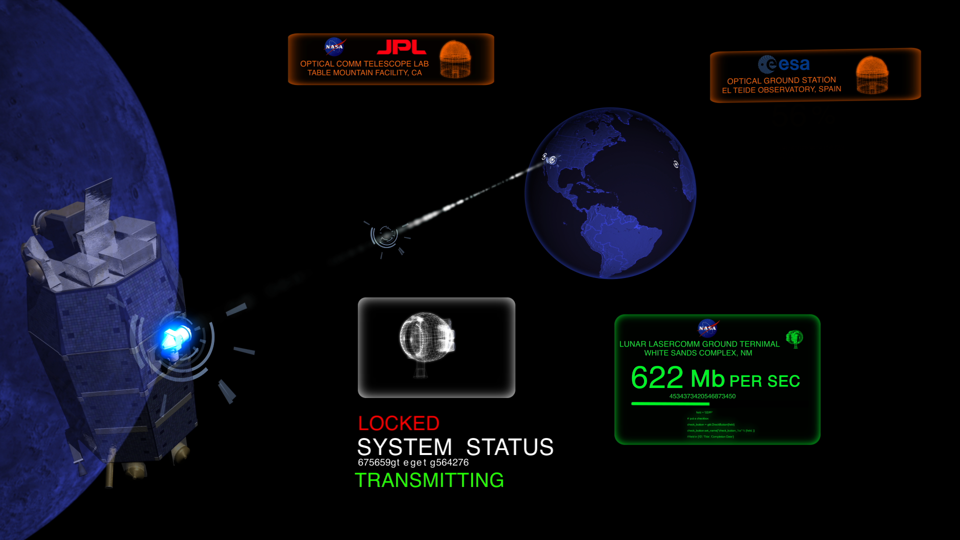
Go to this pageLLCD will be NASA's first-step in creating a high performance space-based laser communications system. The LLCD mission consists of space-based and ground-based components. The Lunar Laser Space Terminal (LLST) is an optical communications test payload to fly aboard the LADEE Spacecraft and it will demonstrate laser communications from lunar orbit.The ground segment consists of three ground terminals that will perform high-rate communication with the LLST aboard LADEE. The primary ground terminal, the Lunar Laser Ground Terminal (LLGT) is located in White Sands, NM and was developed by MIT/Lincoln Laboratory and NASA. The ground segment also includes two secondary terminals located at NASA/JPL's Table Mountain Facility in California and the European Space Agency's El Teide Observatory in Tenerife, Spain. The main goal of LLCD is proving fundamental concepts of laser communications and transferring data at a rate of 622 megabits per second (Mbps), which is about five times the current state-of-the-art from lunar distances. Engineers expect future space missions to benefit greatly from the use of laser communications technology. To learn more about laser communications and the LLCD mission please click here. ||


