Goddard From Above
Overview
This is an expanding collection of aerial images and 4K video of NASA's Goddard Space Flight Center. Each group contains footage of the specific buildings or campus areas described in its title, along with nearby features, and in most cases includes a brief summary of the shots available in each video sequence.
Drone footage
Aerial Views of Goddard: Visitor Center
Go to this pageGeneral afternoon drone footage of the rocket garden, flights between the Visitor Center and Gift Shop toward and away from the rocket garden, and ascents and descents along the Delta B looking west-northwest into the center. Captured June 13, 2023.Credit: NASA/Francis Reddy || Summer_VC_general_still.jpg (3840x2160) [2.5 MB] || Goddard_VCSummerGeneral_1080_30_15mbps.webm (1920x1080) [24.7 MB] || Goddard_VCSummerGeneral_1080_30_15mbps.mp4 (1920x1080) [370.4 MB] || Goddard_VCSummerGeneral_4k60_25mbps.mp4 (3840x2160) [617.5 MB] || Goddard_VCSummer_General_4k60_100mbps.mp4 (3840x2160) [2.4 GB] ||
Aerial Views of Goddard: Integration and Test Facilities
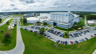
Go to this pageBuilding 29, home of the largest high-bay clean room in the world, stands prominently in this panoramic aerial view of NASA's Goddard Space Flight Center in Greenbelt, Maryland. The clean room is as tall as an eight-story building and as wide as two basketball courts. The circular structure left of center houses the High Capacity Centrifuge, which is used to simulate launch and landing loads on spacecraft hardware. Imaged Oct. 5, 2023, looking south-southwest.Credit: NASA/Francis Reddy || B29_pano_01_10_05_2023_looking_SSW_1080.jpg (2434x1080) [1.7 MB] || B29_pano_01_10_05_2023_looking_SSW_3840.jpg (8653x3840) [16.5 MB] || B29_pano_01_10_05_2023_looking_SSW_1080_searchweb.png (320x180) [128.1 KB] || B29_pano_01_10_05_2023_looking_SSW_1080_thm.png (80x40) [23.3 KB] || B29_pano_01_10_05_2023_looking_SSW.tif (13745x6100) [479.8 MB] ||
Aerial Views of Goddard: 180- and 360-Degree Panoramas
Go to this pageTwo 180-degree pans from above the Goddard Main Gate sign in midday sun and fall colors. The first is fairly slow, the return pan is faster. Greenbelt Road is prominent at the start and end. Captured Nov. 9, 2023.Credit: NASA/Francis Reddy || Goddard_Panorama_From_Main_Gate_Still.jpg (3840x2160) [3.5 MB] || Goddard_Panorama_From_Main_Gate_Still_searchweb.png (320x180) [120.0 KB] || Goddard_Panorama_From_Main_Gate_Still_thm.png (80x40) [7.8 KB] || Goddard_PanoramaFromMainGate_clip_11132023_1080_30_15mbps.mp4 (1920x1080) [306.9 MB] || Goddard_PanoramaFromMainGate_clip_11092023_4k60_25mbps.mp4 (3840x2160) [511.6 MB] || Goddard_PanoramaFromMainGate_clip_11092023_4k60_100mbps.mp4 (3840x2160) [2.0 GB] ||
Aerial Views of Goddard: Main Gate
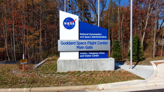
Go to this pageViews of the Goddard Main Gate sign. The first clip shows the sign up close, then the camera pulls back swiftly. The other clips begin close to the sign and rise over the center at different speeds, looking northwest. Captured Nov. 9, 2023.Credit: NASA/Francis Reddy || Main_Gate_Still.jpg (3840x2160) [4.1 MB] || Main_Gate_Still_searchweb.png (320x180) [123.3 KB] || Main_Gate_Still_thm.png (80x40) [7.6 KB] || Goddard_MainGate_clips_11092023_1080_30_15mbps.mp4 (1920x1080) [209.6 MB] || Goddard_MainGate_clips_11092023_4k60_25mbps.mp4 (3840x2160) [346.5 MB] || Goddard_MainGate_clips_11092023_4k60_100mbps.mp4 (3840x2160) [1.3 GB] ||
Aerial Views of Goddard: Buildings 32 and 33
Go to this pageViews of the east side of Building 32 in morning light and fall colors. Several clips fly toward and away from the east entrance. The next set of clips rise to various heights above the building. The final shot stays above the building and pulls back, looking west. Captured Nov. 9, 2023.Credit: NASA/Francis Reddy || Building_32_East_Corner_Close_Still.jpg (3840x2160) [3.3 MB] || Building_32_East_Corner_Close_Still_searchweb.png (320x180) [104.5 KB] || Building_32_East_Corner_Close_Still_thm.png (80x40) [6.7 KB] || Goddard_Bldg32EastCornerClose_clips_11092023_1080_30_15mbps.mp4 (1920x1080) [306.8 MB] || Goddard_Bldg32EastCornerClose_clips_11092023_4k60_25mbps.mp4 (3840x2160) [511.5 MB] || Goddard_Bldg32EastCornerClose_clips_11092023_4k60_100mbps.mp4 (3840x2160) [2.0 GB] ||
Aerial Views of Goddard: Buildings 21 and 11
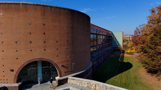
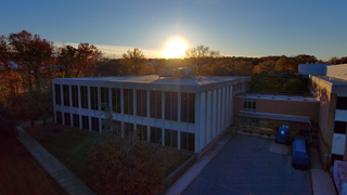
Go to this pageThis sequence shows the northeast corner of Building 21, with the Goddard Library, near sunset and in fall colors, looking southwest. The first shot approaches the building horizontally at low altitude. The next shows a descent from moderate altitude, with Building 11 visible in the background; the following shot shows a rise to similar height and a similar descent. The next shot features a slow descent from several hundred feet, looking southwest into the sun and toward Building 11, followed by an ascent at similar pace and height. Captured Nov.14, 2023. Credit: NASA/Francis Reddy || Building_21_Library_Corner_Sunset_Still.jpg (3840x2160) [2.3 MB] || Building_21_Library_Corner_Sunset_Still_searchweb.png (320x180) [85.5 KB] || Building_21_Library_Corner_Sunset_Still_thm.png (80x40) [6.2 KB] || Goddard_Bldg21CornerSunset_clips_11132023_1080_30_15mbps.mp4 (1920x1080) [383.1 MB] || Goddard_Bldg21CornerSunset_clips_11132023_4k60_25mbps.mp4 (3840x2160) [638.6 MB] || Goddard_Bldg21CornerSunset_clips_11132023_4k60_100mbps.mp4 (3840x2160) [2.5 GB] ||
Aerial Views of Goddard: Miscellaneous
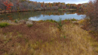
Go to this pageViews in the vicinity of the pond and wooded area in the northwest of Goddard's campus. The first sequence is an ascent, followed by a descent, looking northwest. The next clip flies horizontally across the pond at low altitude. The following clip transitions from a position just above the pond, flying southeast, and rises to reveal Buildings 20, 28, and the broader Goddard campus. The next shot flies the same path in reverse at slower speed. Credit: NASA/Francis Reddy || Goddard_Pond_Still.jpg (3840x2160) [3.4 MB] || Goddard_Pond_Still_searchweb.png (320x180) [106.0 KB] || Goddard_Pond_Still_thm.png (80x40) [6.8 KB] || Goddard_Pond_clips_11092023_1080_30_15mbps.mp4 (1920x1080) [459.2 MB] || Goddard_Pond_clips_11092023_4k60_25mbps.mp4 (3840x2160) [765.3 MB] || Goddard_Pond_clips_11092023_4k60_100mbps.mp4 (3840x2160) [3.0 GB] ||
Aerial Views of Goddard: General Campus
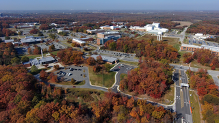
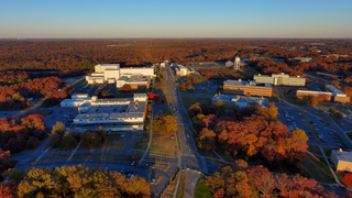
Go to this pageViews of the Goddard campus, from various heights, looking northeast from above Building 21, with fall colors in the late afternoon and magic hour. Several shots rise from below the tree line. Others fly forward or backward, looking toward the Integration and Test facilities prominent in the background.Credit: NASA/Francis Reddy || Goddard_from_Building_21_Sunset_Still.jpg (3840x2160) [3.0 MB] || Goddard_from_Building_21_Sunset_Still_searchweb.png (320x180) [105.1 KB] || Goddard_from_Building_21_Sunset_Still_thm.png (80x40) [7.0 KB] || Goddard_CampusSunsetFrom21_clips_11132023_1080_30_15mbps.mp4 (1920x1080) [675.6 MB] || Goddard_CampusSunsetFrom21_clips_11132023_4k60_25mbps.mp4 (3840x2160) [1.1 GB] || Goddard_CampusSunsetFrom21_clips_11132023_4k60_100mbps.mp4 (3840x2160) [4.4 GB] ||
Aerial Views of Goddard: Buildings 20 and 28
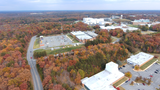
Go to this pageA variety of clips showing flights from the wooded area in the northwest of the Goddard campus favoring Buildings 20 and 28, looking east. Some shots ascend from below the tree tops to reveal the center; others descend below the tree tops. Captured Nov. 9, 2023.Credit: NASA/Francis Reddy || Buildings_20_and_28_Still.jpg (3840x2160) [3.5 MB] || Buildings_20_and_28_Still_searchweb.png (320x180) [112.8 KB] || Buildings_20_and_28_Still_thm.png (80x40) [7.6 KB] || Goddard_Bldg20and28_clips_11132023_1080_30_15mbps.mp4 (1920x1080) [760.6 MB] || Goddard_Bldg20and28_clips_11132023_4k60_25mbps.mp4 (3840x2160) [1.2 GB] || Goddard_Bldg20and28_clips_11132023_4k60_100mbps.mp4 (3840x2160) [4.9 GB] ||
Aerial Views of Goddard: 2023 Wildfire Smoke
Go to this pageThis panorama of NASA Goddard was taken on the morning of June 7, 2023, when smoke from raging wildfires in Eastern Canada wafted over the Mid-Atlantic region. The Integration and Test complex is located at top center in this view, looking north.Credit: NASA/Francis Reddy || Wildfire_Smoke_am_GSFC_06072023_looking_N.jpg (7500x3167) [7.9 MB] || Wildfire_Smoke_am_GSFC_06072023_looking_N_print.jpg (1024x432) [292.8 KB] || Wildfire_Smoke_am_GSFC_06072023_looking_N_searchweb.png (320x180) [111.8 KB] || Wildfire_Smoke_am_GSFC_06072023_looking_N_thm.png (80x40) [20.7 KB] ||

