NASA Measures Holiday Lights from Space
Overview
It’s official — our holiday lights are so bright we can see them from space. Thanks to the VIIRS instrument on the Suomi NPP satellite, a joint mission between NASA and NOAA, scientists are presenting a new way of studying satellite data that can illustrate patterns in holiday lights, both during Christmas and the Holy Month of Ramadan. These new tools can provide new insights into how energy consumption behaviors vary across different cultural settings.
To download images of the Holiday Night Lights data, visit: https://www.flickr.com/photos/gsfc/sets/72157649384170588/
No Section Name
NASA Sees Holiday Lights from Space
Go to this pageFor complete transcript, click here. || Holiday_Night_Lights_nasaportal_print.jpg (1024x576) [92.5 KB] || Holiday_Night_Lights_nasaportal.00027_print.jpg (1024x576) [86.9 KB] || Holiday_Night_Lights_nasaportal_searchweb.png (180x320) [66.3 KB] || Holiday_Night_Lights_nasaportal_web.png (320x180) [66.3 KB] || Holiday_Night_Lights_nasaportal_thm.png (80x40) [5.1 KB] || Holiday_Night_Lights_ProRes.mov (1280x720) [4.4 GB] || Holiday_Night_Lights_appletv.m4v (960x540) [118.6 MB] || Holiday_Night_Lights_appletv_subtitles.m4v (960x540) [118.5 MB] || Holiday_Night_Lights_Final_720x480.webm (720x480) [32.7 MB] || Holiday_Night_Lights_nasaportal.mov (640x360) [101.8 MB] || Holiday_Night_Lights_ipod_lg.m4v (640x360) [48.5 MB] || Holiday_Night_Lights_Final_720x480.wmv (720x480) [102.9 MB] || Holiday_Night_Lights.en_US.srt [6.1 KB] || Holiday_Night_Lights.en_US.vtt [6.1 KB] || Holiday_Night_Lights_ipod_sm.mp4 (320x240) [23.5 MB] ||
No Section Name
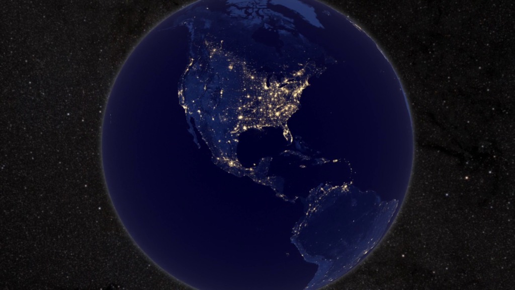
Earth At Night
Go to this pageIn daylight our big blue marble is all land, oceans and clouds. But the night - is electric.This view of Earth at night is a cloud-free view from space as acquired by the Suomi National Polar-orbiting Partnership Satellite (Suomi NPP). A joint program by NASA and NOAA, Suomi NPP captured this nighttime image by the satellite's Visible Infrared Imaging Radiometer Suite (VIIRS). The day-night band on VIIRS detects light in a range of wavelengths from green to near infrared and uses filtering techniques to observe signals such as city lights, gas flares, and wildfires. This new image is a composite of data acquired over nine days in April and thirteen days in October 2012. It took 312 satellite orbits and 2.5 terabytes of data to get a clear shot of every parcel of land surface.This video uses the Earth at night view created by NASA's Earth Observatory with data processed by NOAA's National Geophysical Data Center and combined with a version of the Earth Observatory's Blue Marble: Next Generation. ||

