NASA Captures Hurricane Harvey's Rainfall
Music: "Whirlpool," Michael Jan Levine, Killer Tracks
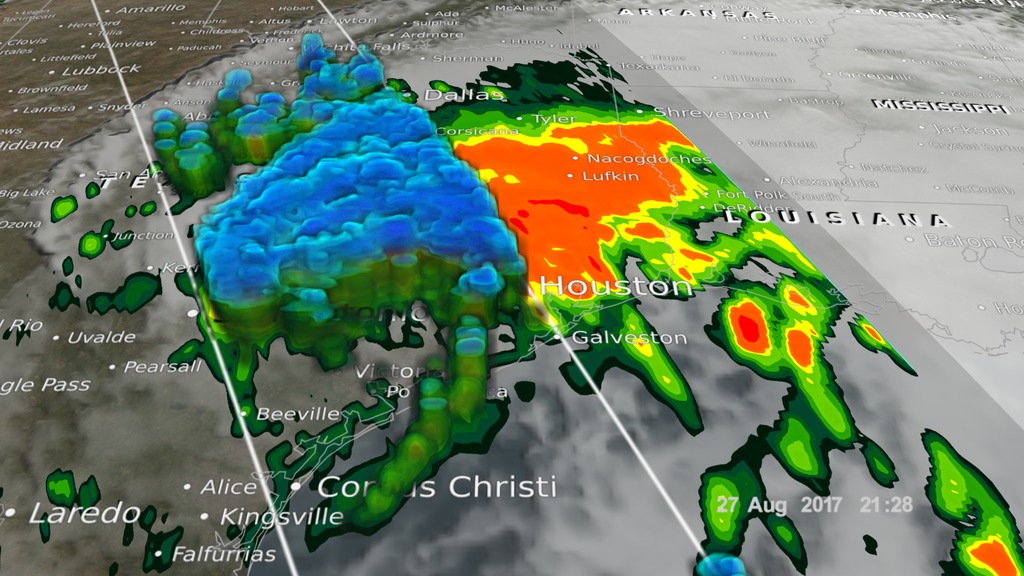
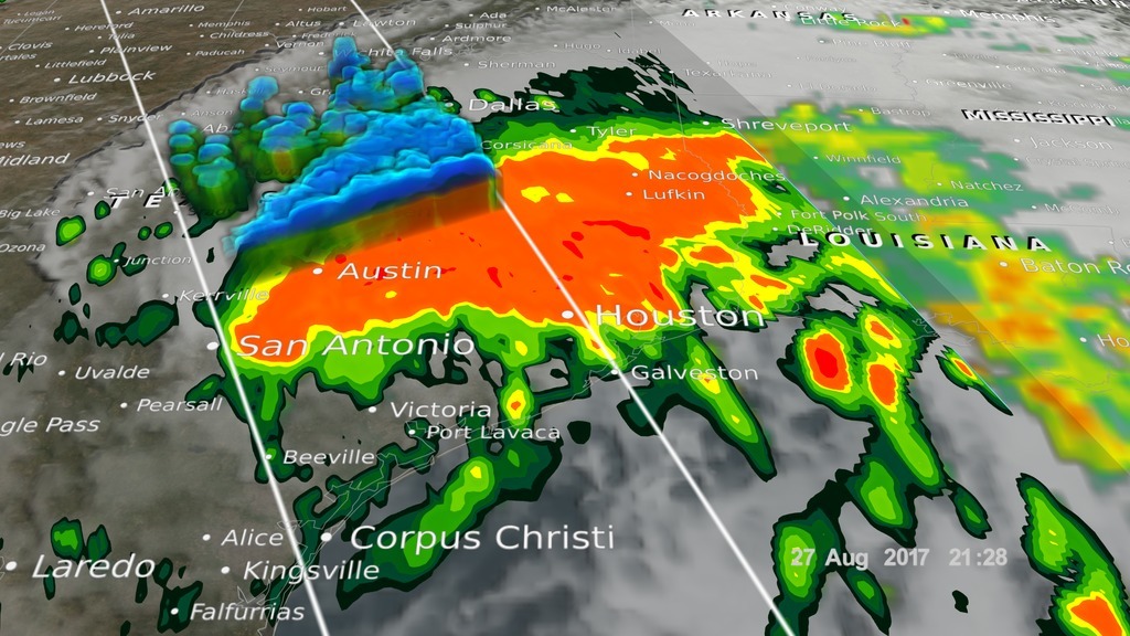
The Global Precipitation Measurement (GPM) Core Observatory captured these images of Hurricane Harvey at 11:45 UTC and 21:25 UTC on the 27th of August nearly two days after the storm made landfall as it was meandering slowly southeast at just 2 mph (~4 kph) near Victoria, Texas west of Houston. The image shows rain rates derived from GPM's GMI microwave imager (outer swath) and dual-frequency precipitation radar or DPR (inner swath) overlaid on enhanced visible/infrared data from the GOES-East satellite. Harvey's cyclonic circulation is still quite evident in the visible/infrared clouds, but GPM shows that the rainfall pattern is highly asymmetric with the bulk of the rain located north and east of the center. A broad area of moderate rain can be seen stretching from near Galveston Bay to north of Houston and back well to the west. Within this are embedded areas of heavy rain (red areas); the peak estimated rain rate from GPM at the time of this overpass was 96 mm/hr (~3.77 inches per hour). With Harvey's circulation still reaching out over the Gulf, the storm is able to draw in a continuous supply of warm moist air to sustain the large amount of rain it is producing.
This is the visualization only, which runs up through August 30, 2017. This has no music or text overlays, only the color bars.
Credits
Please give credit for this item to:
NASA's Goddard Space Flight Center
-
Producer
- Ryan Fitzgibbons (USRA)
-
Visualizer
- Alex Kekesi (Global Science and Technology, Inc.)
-
Scientist
- George Huffman (NASA/GSFC)
-
Writer
- Stephen Lang (NASA/GSFC)
-
Data provider
- Hal Pierce (SSAI)
Release date
This page was originally published on Wednesday, August 30, 2017.
This page was last updated on Wednesday, May 3, 2023 at 1:47 PM EDT.

![Watch this video on the NASA Goddard YouTube channel.Complete transcript available.Music credits: 'Micro Currents' by Jean-Patrick Voindrot [SACEM], 'Sink Deep' by Andrew Michael Britton [PRS], David Stephen Goldsmith [PRS], Mikey Rowe [PRS] from Killer Tracks.](/vis/a010000/a012700/a012738/LARGE_MP4-12738_RapidIntensification_large.00084_print.jpg)


