Near Real-Time Global Precipitation from the Global Precipitation Measurement Constellation
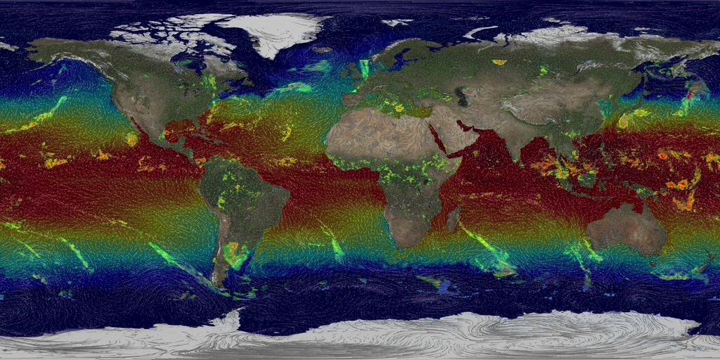
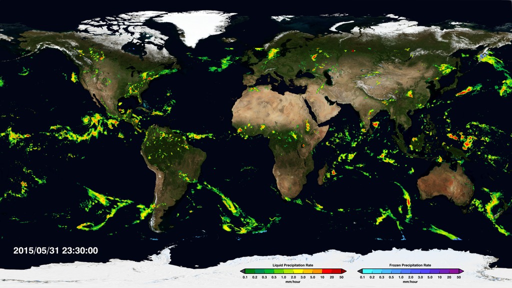
An animation of the most currently available global precipitation data from IMERG.
The Global Precipitation Measurement (GPM) mission produces NASA's most comprehensive global rain and snowfall product to date, called the Integrated Multi-satellite Retrievals for GPM (IMERG). It is computed using data from the GPM constellation of satellites — a network of international satellites that currently includes the GPM Core Observatory, GCOM-W1, NOAA-18, NOAA-19, DMSP F-16, DMSP F-17, DMSP F-18, Metop-A, and Metop-B. The global IMERG dataset provides precipitation rates for the entire world every 30 minutes. Although the process to create the combined dataset is intensive, the GPM team creates a preliminary, near-real-time dataset of precipitation within several hours of data acquisition. This visualization shows the most currently available precipitation data from IMERG, depicting how rain and snowstorms move around the planet. As scientists work to understand all the elements of Earth's climate and weather systems, and how they could change in the future, GPM provides a major step forward in providing comprehensive and consistent measurements of precipitation for scientists and a wide variety of user communities.

Colorbar for frozen precipitation

Color bar for liquid precipitation

An image of the most currently available global precipitation data from IMERG.
Credits
Please give credit for this item to:
NASA's Scientific Visualization Studio.
-
Animator
- Horace Mitchell (NASA/GSFC)
-
Scientists
- George Huffman (NASA/GSFC)
- Gail Skofronick Jackson (NASA/GSFC)
- Dalia B Kirschbaum (NASA/GSFC)
-
Programmer
- Leann Johnson (Global Science and Technology, Inc.)
-
Producer
- Ryan Fitzgibbons (USRA)
Release date
This page was originally published on Tuesday, March 31, 2015.
This page was last updated on Saturday, April 26, 2025 at 12:20 PM EDT.
Missions
This page is related to the following missions:Series
This page can be found in the following series:Datasets used
-
IMERG
ID: 863This dataset can be found at: http://pmm.nasa.gov/sites/default/files/document_files/IMERG_ATBD_V4.4.pdf
See all pages that use this dataset
Note: While we identify the data sets used on this page, we do not store any further details, nor the data sets themselves on our site.


![This is a 360° video that can be downloaded and viewed on 360° video platforms such as YouTube and Facebook. Complete transcript available.Music credit: "The Answer" by Laurent Levesque [SACEM] from Killer Tracks](/vis/a010000/a013000/a013079/Inside_Hurricane_Maria_in_360.00001_print.jpg)




![Music: Futurity by Lee Groves [PRS] and Peter George Marett [PRS]Complete transcript available.](/vis/a010000/a013900/a013979/Screen_Shot_2021-10-28_at_2.29.18_PM.png)
![Complete transcript available.Music credits: “Billy” by Rob Jager [BUMA]; “Perfect Space” by Anthony Edwin Phillips [PRS], Samuel Karl Bohn [PRS]; “Games Show Spheres 07” by Anselm Kreuzer [GEMA]; “Hope Will Save Us” by Christopher John Hutchings [PRS]
Additional imagery credit: University of Washington Watch this video on the NASA Goddard YouTube channel.](/vis/a010000/a013500/a013592/13592_FarmersGPM_YouTube.00001_print.jpg)

![Complete transcript available.Music credit: “Reach Into The Night” by Andrew Michael Britton [PRS], David Stephen Goldsmith [PRS], Mikey Rowe [PRS] and “Progressive Practice” by Emmanuel David Lipszyc [SACEM], Franck Lascombes [SACEM], Sebastien Charles Lipszyc [SACEM] From Killer TracksWatch this video on the NASA Goddard YouTube channel.](/vis/a010000/a012800/a012848/12848_ICEPOP_Final.00547_print.jpg)