Tracking methane with EMIT and AVIRIS-3


Image slider to compare EMIT and AVIRIS-3 methane plume observations near the Permian Basin, in New Mexico.
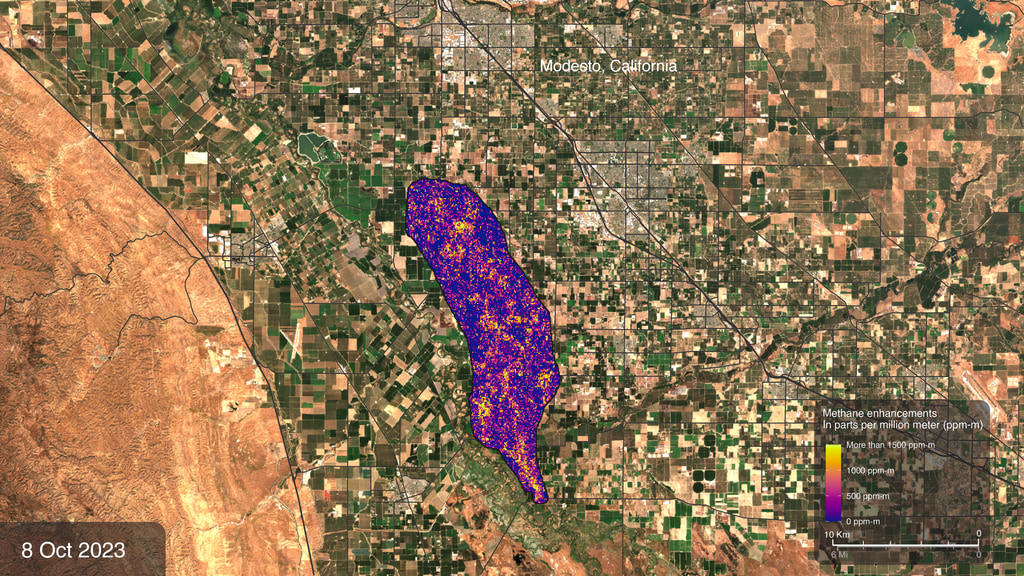
Methane plumes can now be detected using the airborne AVIRIS-3 spectrometer in addition to EMIT on the International Space Station. This data visualization shows coincident AVIRIS-3 and EMIT observations (within seconds) near the Permian Basin, in New Mexico.
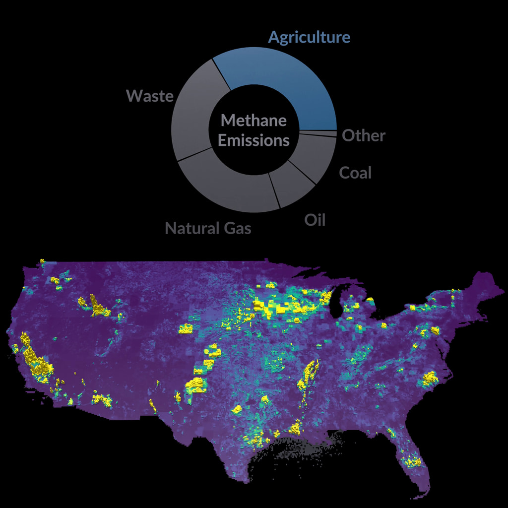
The Earth Surface Mineral Dust Source Investigation (EMIT) mission uses an imaging spectrometer to detect the unique pattern of reflected and absorbed light – called a spectral fingerprint – from various materials on Earth's surface and in its atmosphere. Perched on the International Space Station, EMIT was originally intended to map the prevalence of minerals in Earth's arid regions, such as the deserts of Africa and Australia. Scientists verified that EMIT could also detect the spectral fingerprints of methane and carbon dioxide which enables mapping of emissions from the energy, waste, and agriculture sectors.
In 2023, NASA began flying a new airborne instrument to measure methane and carbon dioxide point source emissions data in much the same way that EMIT does from space. AVIRIS-3 stands for the third generation of Airborne Visible/Infrared Imaging Spectrometers. It is an advanced imaging system developed and operated by NASA's Jet Propulsion Laboratory (JPL). Designed to capture high-resolution data of Earth's surface in visible and infrared wavelengths analogous to EMIT measurements. AVIRIS-3 is an ideal companion instrument to EMIT, offering enhanced greenhouse gas sensitivity from locations much closer to the ground. AVIRIS-3 can be flown on a variety of aircraft.
Simultaneously observing a large methane emission event with AVIRIS-3 and EMIT allows for direct comparison of greenhouse gas retrievals and emission estimates derived from concurrent airborne and satellite measurements. This type of coordinated measurement and evaluation is referred to by scientists as calibration and validation. This is a critical process for space and airborne scientific instruments, during which data are calibrated, validated, and verified to ensure accuracy, reliability, and consistency.
Comparison of EMIT and AVIRIS-3 methane plume observations near the Permian Basin, in New Mexico.

Methane plume detected by airborne AVIRIS-3 spectrometer.
Title and location labeling included.

Methane plume observed by the EMIT instrument on the International Space Station.
Title and location labeling included.

Methane plume detected by airborne AVIRIS-3 spectrometer near the Permian Basin, in New Mexico.
Title and location labeling not included.

Methane plume detected by airborne AVIRIS-3 spectrometer.
This version includes location label.

Methane plume observed by the EMIT instrument on the International Space Station.
This version includes location label.

Methane plume observed by the EMIT instrument on the International Space Station, near the Permian Basin, in New Mexico.
Title and location labeling not included.
For More Information
See the following sources:
For More Information
Credits
Please give credit for this item to:
NASA's Scientific Visualization Studio
-
Visualizers
- Zoey N. Armstrong (Navteca, LLC.)
- Helen-Nicole Kostis (USRA)
-
Research technologist
- Andrew Thorpe (NASA/JPL, California Institute of Technology)
- Philip Brodrick (NASA/JPL, California Institute of Technology)
-
Technical support
- Laurence Schuler (ADNET Systems, Inc.)
- Ian Jones (ADNET Systems, Inc.)
Release date
This page was originally published on Thursday, November 14, 2024.
This page was last updated on Tuesday, November 19, 2024 at 3:14 PM EST.
Missions
This page is related to the following missions:Datasets used
-
VISIONS: The EMIT Open Data Portal [International Space Station (ISS): Earth Surface Mineral Dust Source Investigation (EMIT)]
ID: 1210The Earth Surface Mineral Dust Source Investigation (EMIT) instrument measures surface mineralogy, targeting the Earth’s arid dust source regions. EMIT is installed on the International Space Station (ISS) and uses imaging spectroscopy to take measurements of the sunlit regions of interest between 52° N latitude and 52° S latitude.
Credit: Jet Propulsion Laboratory, California Institute of Technology
This dataset can be found at: https://earth.jpl.nasa.gov/emit/data/data-portal/Greenhouse-Gases/
See all pages that use this dataset -
AVIRIS-3 L2B Greenhouse Gas Enhancements, Facility Instrument Collection
ID: 1229This dataset contains Level 2B (L2b) enhancements of greenhouse gasses (GHG) derived from imagery collected by the Airborne Visible / Infrared Imaging Spectrometer-3 (AVIRIS-3) instrument. Products include methane and carbon dioxide enhancements, each with per-pixel uncertainties and sensitivities to the background. Concentration enhancements are estimated from radiance measurements using a column-wise adaptive matched filter approach, which searches each pixel's radiance spectrum for deviations that are characteristic of a GHG's absorption spectrum. This is the NASA Earth Observing System Data and Information System (EOSDIS) facility instrument archive of these data. The NASA AVIRIS-3 is a spectral mapping system that measures reflected radiance at 7.4-nm intervals in the Visible to Shortwave Infrared (VSWIR) spectral range from 390-2500 nm.
Credit: Chlus, A. M., Brodrick, P. G., Thorpe, A. K., Chapman, J. W., Jensen, D. J., Coleman, R. W., Fahlen, J., Olson-Duvall, W., Thompson, D. R., & Green, R. O. (2024). AVIRIS-3 L2B Greenhouse Gas Enhancements, Facility Instrument Collection (Version 1). ORNL Distributed Active Archive Center. x
This dataset can be found at: https://doi.org/10.3334/ornldaac/2358
See all pages that use this dataset
Note: While we identify the data sets used on this page, we do not store any further details, nor the data sets themselves on our site.


