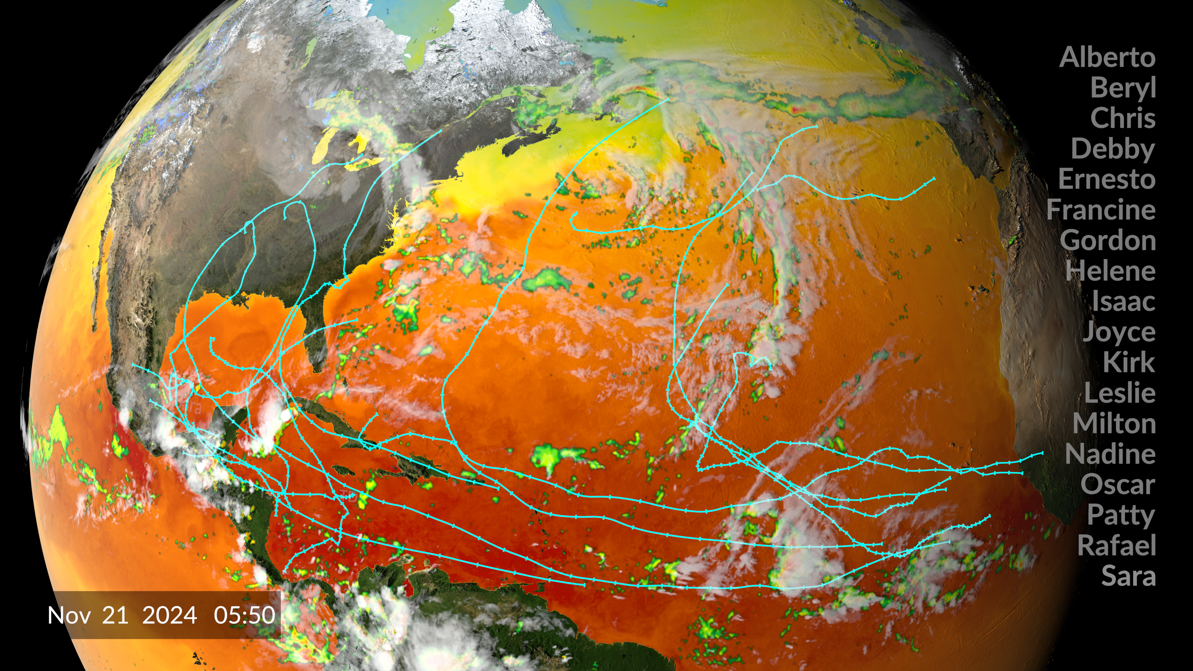
2024 Atlantic Hurricane Season (Vertical Mode)
Example composite of how this data visualization might be used on a vertical display.
Data visualization of the 2024 Atlantic hurricane season showing the interaction between sea surface temperatures, IMERG surface precipitation, GOES cloud cover data, and hurricane tracking information. This version was specifically created for vertical screens.
Raw vertically rendered frames showing the 2024 hurricane season via sea surface temperatures (SSTs), IMERG precipitation, GOES cloud cover, and ATCF hurricane tracks. This version also includes burned in dates for each frame as well as a list of 2024 hurricane names beneath it. The end of the visualization dissolves away the dates and all the relavent datasets, except for the hurricane tracks, which appear together along with each named storm.

Vertical colorbar for the IMERG precipitation data. The left hand side of the colorbar range from green to yellow to red and indicate rain rates from 0.1 mm/hr to over 50 mm/hr. The right hand side of the vertical colorbar moves from cyan to blue to violet indicating frozen precipitation rates also ranging from 0.1 mm/hr to over 50 mm/hr.

Vertical colorbar ranging from dark blue to green to yellow to red where the colors represent increasing sea surface temperatures from less than 20 Celsius to over 30 Celsius.
Credits
Please give credit for this item to:
NASA's Scientific Visualization Studio
-
Data visualizers
- Alex Kekesi (Global Science and Technology, Inc.)
- Greg Shirah (NASA/GSFC)
- Kel Elkins (USRA)
-
Technical support
- Laurence Schuler (ADNET Systems, Inc.)
- Ian Jones (ADNET Systems, Inc.)
Release date
This page was originally published on Friday, March 7, 2025.
This page was last updated on Wednesday, March 12, 2025 at 7:42 AM EDT.
Datasets used
-
CPC (Climate Prediction Center) Cloud Composite
ID: 600Global cloud cover from multiple satellites
See all pages that use this dataset -
MUR SST (Multi-scale Ultra-high Resolution (MUR) Sea Surface Temperature (SST) Analysis)
ID: 845 -
IMERG
ID: 863This dataset can be found at: http://pmm.nasa.gov/sites/default/files/document_files/IMERG_ATBD_V4.4.pdf
See all pages that use this dataset -
Hurricane Tracks (Automated Tropical Cyclone Forecast (ATCF) - Best Track)
ID: 1109Credit: NOAA
This dataset can be found at: https://ftp.nhc.noaa.gov/atcf/
See all pages that use this dataset
Note: While we identify the data sets used on this page, we do not store any further details, nor the data sets themselves on our site.
