SVS Image Server
Tutorial Introduction
A user accesses the information on the SVS Image Server in one of three ways:
- with a standard web browser, which will allow the user to browse the individual products,
- with more advanced software that allows viewing the products on an interactive 3D Earth globe,
- with any software application that supports the Web Map Service (WMS) protocol.
To browse the individual products, go to the Available Animation List. To view the products in 3D on a Windows-based PC, download NASA's WorldWind software. This tutorial is for developers who wish to create WMS-based software to access the products on the SVS Image server. The tutorial is both an introduction to the WMS protocols and a description of the specific ways that this server implements those protocols.
Using the WMS protocols, the client application asks the server for a "table of contents" and then for specific images, e.g.,
PC Client - "What animations and images do you have?"
SVS Image Server - "I have
+ Global Ozone during the 2003 Ozone Hole
+ Global Atmospheric Carbon Monoxide in 2000
+ Cold Water Trails from Hurricanes Fabian and Isabel
+ African Fires during 2002
+ etc."
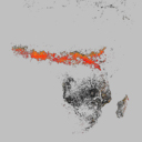
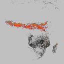
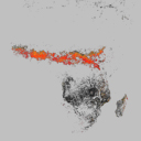
PC Client - "Give me 'African Fires during 2002'"
SVS Image Server - "Here are the images:
 ,
,  ,
,  , etc."
The subsequent pages of this document describe in more precise terms how to access content on the SVS Image Server, starting by expanding on this example.
Go backward to the "Overview"
Go forward to "Accessing the Table of Contents"
Table of Contents
SVS Image Server Home PageOverview
Tutorial Introduction
Accessing the Table of Contents
Asking for an Image
Asking for an Animation
Asking for an Image Sequence
Design Considerations - Fixed Size Images
Design Considerations - Projections
Styles and Legends
Metadata - Abstracts and Keywords
Metadata - Attributions and FGDC Metadata
Appendices
StandardsAvailable Animations List