The Geosynchronous orbits of the GeoXO Satellites
This visualization shows the geosynchornous orbits of the three satellites in the GeoXO satellite system: GEO West, GEO Center and GEO East satellites.
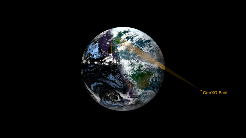
This visualization shows the geosynchronous orbits of the three GeoXO geostationary satellites: GEO West, GEO Center and GEO East. The view frustrum emanating from each satellite depicts each satellite's coverage area, both over the land and the water. Chlorophyll measurements in aqua and purple show the regions where the ocean health will be monitored.
NOAA’s Geostationary Extended Observations (GeoXO) satellite system will expand observations of Earth that the GOES-R Series currently provides from geostationary orbit. GeoXO will watch over the Western Hemisphere as part of NOAA’s observing system that supports short-term forecasts and warnings of extreme weather and environmental hazards. To assist with long-term planning, this observing system will deliver information that sophisticated climate-forecasting models use to predict weather patterns, including emerging patterns caused by climate change. NOAA expects that GeoXO will begin operating in the early 2030s as the GOES-R Series nears the end of its operational lifetime.

This image shows the coverage of the GeoXO satellite system over North and South America.

This image shows the orbits of the three GeoXO satellites viewed from above the North Pole.

This image shows the western coverage of the GEO West satellite.

This image shows the eastern coverage of the GEO East satellite.
Credits
Please give credit for this item to:
NASA's Scientific Visualization Studio
-
Visualizers
- Cindy Starr (Global Science and Technology, Inc.)
- Greg Shirah (NASA/GSFC)
-
Scientists
- Andrew K. Heidinger (NOAA)
- Dan Lindsey (NOAA)
-
Communications lead
- Michelle Smith (NOAA)
-
Producer
- Elizabeth C. Wilk (eMITS)
-
Technical support
- Ian Jones (ADNET Systems, Inc.)
- Laurence Schuler (ADNET Systems, Inc.)
Release date
This page was originally published on Monday, December 9, 2024.
This page was last updated on Tuesday, February 18, 2025 at 12:13 AM EST.
Datasets used
-
BMNG (Blue Marble: Next Generation) [Terra and Aqua: MODIS]
ID: 508Credit: The Blue Marble data is courtesy of Reto Stockli (NASA/GSFC).
This dataset can be found at: http://earthobservatory.nasa.gov/Newsroom/BlueMarble/
See all pages that use this dataset -
Chlorophyll (Chlorophyll Concentration) [Suomi NPP: VIIRS]
ID: 987
Note: While we identify the data sets used on this page, we do not store any further details, nor the data sets themselves on our site.


![Music:“A Sight To Behold” by Will Slater [PRS] & Benji Paul Merrison [PRS]; BBC Production Music; Universal Production Music“Extrapolations” by Andrii Yefymov [BMI]; Hypersonic Music; Universal Production MusicUsing data from current satellites, A Day in the Life of GeoXO imagines what this new generation of geostationary Earth observing satellites will see, and how their instruments will work together to provide near real-time information to forecasters, decision-makers, and first responders. GeoXO will contribute to the protection of life and property within the United the States. All in a day's work.This video can be freely shared and downloaded. While the video in its entirety can be shared without permission, some individual imagery provided by Artbeats, BlackBoxGuild/Pond5, sinenkiy/Pond5, and Pond5 are obtained through permission and may not be excised or remixed in other products. For more information on NASA’s media guidelines, visit https://www.nasa.gov/multimedia/guidelines/index.html](/vis/a010000/a014700/a014740/YouTubeThumbnail_GeoXO.jpg)