NOAA Coral Reef Watch 2015
The NOAA Coral Reef Watch program's satellite data provide current reef environmental conditions to quickly identify areas at risk for coral bleaching, where corals lose the symbiotic algae that give them their distinctive colors. If a coral is severely bleached, disease and partial mortality become likely, and the entire colony may die.
The satellite data used to create these products includes the polar orbiters Suomi-NPP/VIIRS and MetOp-B/AVHRR, and the geostationary satellites MSG-3, MTSAT-2, GOES-East, and GOES-West.
The NOAA Coral Reef Watch (CRW) daily 5-km satellite Bleaching Alert Area product presented here outlines the areas where coral bleaching thermal stress currently reaches various bleaching stress levels, based on our satellite sea surface temperature (SST) monitoring.
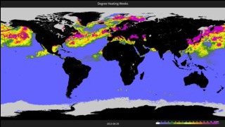
The NOAA Coral Reef Watch (CRW) daily 5-km satellite coral bleaching Degree Heating Week (DHW) product presented here shows accumulated thermal stress, which can lead to coral bleaching and death. The scale goes from 0 to 20 °C-weeks. The DHW product accumulates the instantaneous bleaching thermal stress (measured by Coral Bleaching HotSpots) during the most-recent 12-week period. It is directly related to the timing and intensity of coral bleaching. Significant coral bleaching usually occurs when DHW values reach 4 °C-weeks. By the time DHW values reach 8 °C-weeks, widespread bleaching is likely and significant mortality can be expected.
The NOAA Coral Reef Watch (CRW) daily 5-km Coral Bleaching HotSpot product presented here measures occurrence and magnitude of instantaneous thermal stress, potentially resulting in coral bleaching. The scale goes from 0 to 5 °C. HotSpot values of 1 °C or more indicate thermal stress leading to coral bleaching and are highlighted in yellow to dark red/brown colors.
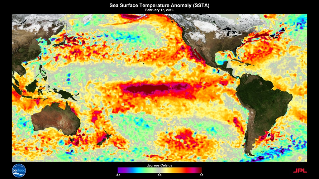
The NOAA Coral Reef Watch (CRW) daily 5-km Sea Surface Temperature (SST) Anomaly product displays the difference between today's SST and the long-term average. The scale goes from -5 to +5 °C. Positive numbers mean the temperature is warmer than average; negative means cooler than average.
The NOAA Coral Reef Watch (CRW) daily 5-km Sea Surface Temperature (SST) product shows the nighttime ocean temperature (at the surface) from the NOAA/NESDIS operational daily global 5-km geostationary-polar-orbiting (Geo-Polar) Blended Night-only SST Analysis. The SST scale ranges from -2 to 35 °C.
For More Information
Credits
Please give credit for this item to:
NOAA Coral Reef Watch
-
Animator
Release date
This page was originally published on Friday, November 27, 2015.
This page was last updated on Monday, February 3, 2025 at 12:44 AM EST.
Related papers
Liu, G.; Heron, S.F.; Eakin, C.M.; Muller-Karger, F.E.; Vega-Rodriguez, M.; Guild, L.S.; De La Cour, J.L.; Geiger, E.F.; Skirving, W.J.; Burgess, T.F.R.; Strong, A.E.; Harris, A.; Maturi, E.; Ignatov, A.; Sapper, J.; Li, J.; Lynds, S. Reef-Scale Thermal Stress Monitoring of Coral Ecosystems: New 5-km Global Products from NOAA Coral Reef Watch. Remote Sens. 2014, 6, 11579-11606.
Liu, G.; Heron, S.F.; Eakin, C.M.; Muller-Karger, F.E.; Vega-Rodriguez, M.; Guild, L.S.; De La Cour, J.L.; Geiger, E.F.; Skirving, W.J.; Burgess, T.F.R.; Strong, A.E.; Harris, A.; Maturi, E.; Ignatov, A.; Sapper, J.; Li, J.; Lynds, S. Reef-Scale Thermal Stress Monitoring of Coral Ecosystems: New 5-km Global Products from NOAA Coral Reef Watch. Remote Sens. 2014, 6, 11579-11606.
Datasets used
-
VIIRS [Suomi NPP: VIIRS]
ID: 722 -
[MetOp-B: AVHRR]
ID: 903 -
MSG-3 [Meteosat-10: SEVIRI]
ID: 904 -
Himawari-7 [MTSAT-2: Imager]
ID: 905 -
GOES-East [GOES-13/N: Imager]
ID: 906 -
GOES-West [GOES-15/P: Imager]
ID: 907
Note: While we identify the data sets used on this page, we do not store any further details, nor the data sets themselves on our site.

